
Transform Geospatial Data into Actionable Insights

Mining
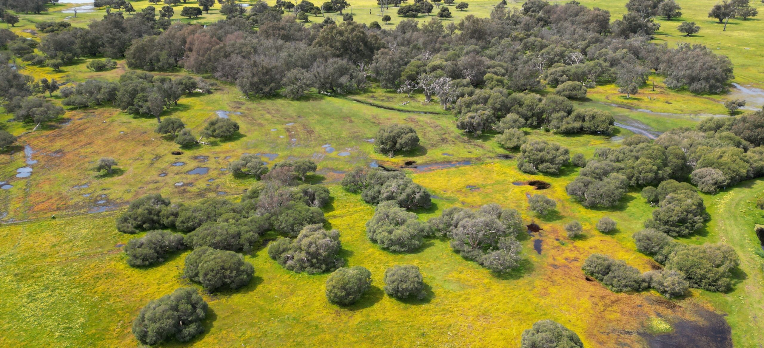
Landform and Rehabilitation

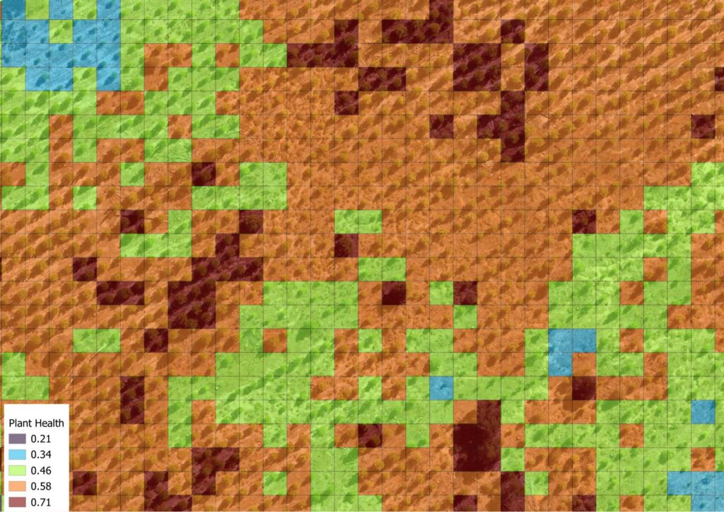
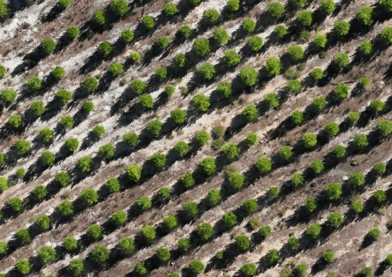
Agriculture
Health monitoring, plants counting and mapping

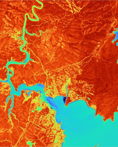
Infrastructure
Modelling and inspection

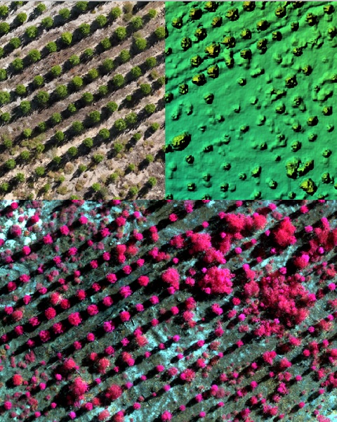
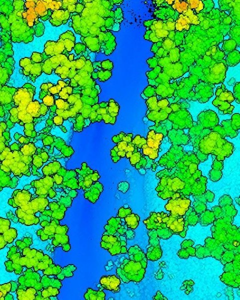
Forestry
Plantation counting
Our Services
Remote Sensing Data Analysis
Combine cutting-edge AI with remote sensing to deliver geospatial intelligence.
Photogrammetry
Transform raw imagery into high quality deliverables such as orthomosaic, DEM and CHM.
Lidar Data Processing
Terrain mapping, point cloud classification and forestry monitoring.
3D Modelling
Build 3D model from photos or point cloud for inspection or visualization.
We integrate AI with geospatial knowledge
Based in Australia, we are a team of Earth Observation experts with over a decade of experience in remote sensing and geospatial intelligence, spanning academia and industry. Our mission is to transform raw geospatial data into actionable insights—helping businesses, researchers, and policymakers make informed decisions.
Whether you need custom analytics, real-time monitoring, or predictive modeling, we provide tailored geospatial solutions to meet your needs.
Our Team
Passionate
Eager to explore data and make an impact. high quality deliverables
Professional
Intensive experience and solid background in geospatial. A team with PhD degrees in remote sensing and photgrammetry.
Support
ready from planning to delivery